Category:Farnley, North Yorkshire
Jump to navigation
Jump to search
village and civil parish in Harrogate, North Yorkshire, England  | |||||
| Upload media | |||||
| Instance of | |||||
|---|---|---|---|---|---|
| Location | Harrogate, North Yorkshire, Yorkshire and the Humber, England | ||||
 | |||||
Subcategories
This category has the following 4 subcategories, out of 4 total.
A
- All Saints, Farnley (7 F)
F
- Farnley Hall, North Yorkshire (12 F)
L
- Lindley Bridge, North Yorkshire (14 F)
Media in category "Farnley, North Yorkshire"
The following 141 files are in this category, out of 141 total.
-
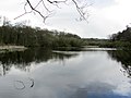
 A full reservoir - geograph.org.uk - 3294771.jpg 4,000 × 3,000; 2.77 MB
-
 A green lane - geograph.org.uk - 606280.jpg 640 × 480; 101 KB
-
 Abandoned Boathouse beside Farnley Lake - geograph.org.uk - 2899374.jpg 4,320 × 3,240; 5.37 MB
-
 Access Drive to Mount Pleasant Farm - geograph.org.uk - 2903632.jpg 4,320 × 3,240; 5.56 MB
-
 Access Track to Haddockstones Farm - geograph.org.uk - 2895555.jpg 4,320 × 3,240; 4.88 MB
-
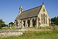
 All Saints Church, Farnley - geograph.org.uk - 2895540.jpg 4,320 × 3,240; 3.2 MB
-
 All Saints Church, Farnley - geograph.org.uk - 3265290.jpg 4,608 × 3,072; 652 KB
-
 All Saints Church, Farnley - geograph.org.uk - 3783296.jpg 1,600 × 1,200; 487 KB
-
 All Saints' Church, Farnley - geograph.org.uk - 3561664.jpg 1,024 × 682; 225 KB
-
 Angler's tent and pony. - geograph.org.uk - 726522.jpg 640 × 480; 102 KB
-
 Arncliffe Crag (3929282184).jpg 2,560 × 1,920; 4.25 MB
-
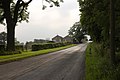
 B6451 leaving Farnley - geograph.org.uk - 5985726.jpg 640 × 480; 51 KB
-
 B6451 towards Rose Tree Farm - geograph.org.uk - 5985734.jpg 640 × 480; 49 KB
-
 B6451, Farnley - geograph.org.uk - 5985720.jpg 640 × 476; 67 KB
-
 Bench Marked Wall, Farnley Park Road - geograph.org.uk - 3086299.jpg 1,024 × 682; 276 KB
-
 Bridge on former Otley-Pool railway - geograph.org.uk - 42284.jpg 640 × 480; 281 KB
-
 Corn field east of Otley - geograph.org.uk - 46024.jpg 640 × 480; 232 KB
-
 Country road towards Farnley - geograph.org.uk - 5986501.jpg 640 × 480; 83 KB
-
 Crag Farm - geograph.org.uk - 3778480.jpg 1,600 × 1,200; 287 KB
-
 Curious Sheep and a molehill - geograph.org.uk - 726516.jpg 640 × 480; 128 KB
-
 Cut Bench Mark, Farnley Park Road - geograph.org.uk - 3086296.jpg 1,024 × 682; 305 KB
-
 Cut Bench Mark, Haddockstones Farm Gatepost - geograph.org.uk - 3561668.jpg 1,024 × 682; 284 KB
-
 Cut Bench Mark, Leathley Bridge - geograph.org.uk - 2560674.jpg 1,024 × 681; 338 KB
-
 Cut Bench Mark, The Square - geograph.org.uk - 2582204.jpg 1,024 × 681; 254 KB
-
 Down to Crag Farm - geograph.org.uk - 4448312.jpg 4,596 × 3,440; 5.9 MB
-
 Driveway, Mount Pleasant Farm - geograph.org.uk - 3052676.jpg 1,024 × 682; 253 KB
-
 East Lodge, Farnley Estate - geograph.org.uk - 3044275.jpg 1,024 × 682; 263 KB
-
 Elizabeth II postbox on Farnley Lane - geograph.org.uk - 5987464.jpg 2,644 × 4,463; 3.59 MB
-
 Entrance Gates to Farnley Hall - geograph.org.uk - 3155949.jpg 3,648 × 2,736; 5.44 MB
-
 Farnley (3928497541).jpg 2,466 × 1,644; 3.96 MB
-
 Farnley Estate land.jpg 640 × 480; 148 KB
-
 Farnley Lake - geograph.org.uk - 2899341.jpg 4,320 × 3,240; 2.77 MB
-
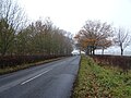
 Farnley Lane (B6451) - geograph.org.uk - 5987466.jpg 4,656 × 3,228; 2.51 MB
-
 Farnley Lane - geograph.org.uk - 3052679.jpg 1,024 × 682; 220 KB
-
 Farnley Lane - geograph.org.uk - 3054103.jpg 1,024 × 682; 195 KB
-
 Farnley Lane, Otley - geograph.org.uk - 3265268.jpg 4,608 × 3,072; 1.51 MB
-
 Farnley Moor - geograph.org.uk - 4448333.jpg 4,518 × 3,334; 5.84 MB
-
 Farnley Park - geograph.org.uk - 5986505.jpg 640 × 480; 88 KB
-
 Farnley Park Road - geograph.org.uk - 3044279.jpg 1,024 × 682; 179 KB
-
 Farnley Road, Otley - geograph.org.uk - 3265849.jpg 4,608 × 3,072; 969 KB
-
 Farnley School - geograph.org.uk - 3054099.jpg 1,024 × 682; 268 KB
-
 Farnley School - geograph.org.uk - 3265857.jpg 4,608 × 3,072; 1.08 MB
-
 Farnley Village Square (3928497121).jpg 1,946 × 1,390; 2.7 MB
-

-
 Field track to Haddockstones Plantation - geograph.org.uk - 4448267.jpg 4,508 × 3,318; 5.56 MB
-
 Fields near Farnley - geograph.org.uk - 3265854.jpg 4,608 × 3,072; 1.07 MB
-
 Footpath beside Lake Plantation - geograph.org.uk - 2899321.jpg 4,320 × 3,240; 3.97 MB
-
 Footpath beside the River Wharfe near The Sandbeds - geograph.org.uk - 3214049.jpg 2,048 × 1,536; 514 KB
-
 Footpath by Lindley Lodge - geograph.org.uk - 179430.jpg 480 × 640; 233 KB
-
 Footpath on The Sandbeds - geograph.org.uk - 2898052.jpg 4,320 × 3,240; 3.92 MB
-

-
 Footpath towards Leathley - geograph.org.uk - 3214056.jpg 2,048 × 1,536; 615 KB
-
 Footpath towards the church at Farnley - geograph.org.uk - 3783290.jpg 1,600 × 1,200; 794 KB
-
 From Farnley Moor into the dale - geograph.org.uk - 4448357.jpg 4,608 × 3,456; 6.63 MB
-
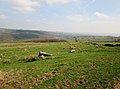
 Grazing near Hasling Hall Farm - geograph.org.uk - 5986500.jpg 640 × 480; 71 KB
-
 Grazing near Rose Tree Farm - geograph.org.uk - 5985742.jpg 640 × 480; 44 KB
-
 Grazing off the B6451 - geograph.org.uk - 5985731.jpg 640 × 480; 50 KB
-
 Haddockstones Farm - geograph.org.uk - 2895568.jpg 4,320 × 3,240; 2.95 MB
-
 Haddockstones Farm - geograph.org.uk - 3561667.jpg 1,024 × 682; 222 KB
-
 Hasling Hall Farm - geograph.org.uk - 3886190.jpg 1,024 × 768; 201 KB
-

-
 Heavy plant in Lindley Wood - geograph.org.uk - 579005.jpg 640 × 480; 182 KB
-
 Hedge side path crossing Playing Field near Otley - geograph.org.uk - 5830116.jpg 4,000 × 3,000; 4.07 MB
-
 Hensan's Beck near River Washburn - geograph.org.uk - 3265208.jpg 4,608 × 3,072; 1.48 MB
-
 Houses on the B6451, Farnley - geograph.org.uk - 5987486.jpg 4,448 × 2,531; 1.57 MB
-
 Knotford Nook - geograph.org.uk - 726515.jpg 480 × 640; 96 KB
-
 Late Autumn at Lindley - geograph.org.uk - 4117341.jpg 1,728 × 1,152; 965 KB
-
 Leathley Bridge - geograph.org.uk - 1057929.jpg 640 × 480; 120 KB
-
 Leathley Bridge - geograph.org.uk - 1058474.jpg 518 × 640; 94 KB
-
 Leathley Bridge - geograph.org.uk - 2560679.jpg 1,024 × 681; 218 KB
-
 Leathley Bridge - geograph.org.uk - 3214070.jpg 2,048 × 1,536; 673 KB
-
 Leathley Bridge spanning the River Washburn - geograph.org.uk - 4443475.jpg 4,291 × 3,075; 6.84 MB
-
 Lindley Bridge - geograph.org.uk - 3783301.jpg 1,600 × 1,200; 1.02 MB
-
 Lindley Bridge over the River Washburn - geograph.org.uk - 3265200.jpg 4,608 × 3,072; 1.49 MB
-
 Lindley Wood Reservoir - geograph.org.uk - 2628132.jpg 3,264 × 2,448; 1.28 MB
-
 Lindley Wood Reservoir - geograph.org.uk - 5985753.jpg 640 × 480; 60 KB
-
 Lindley Wood Reservoir - geograph.org.uk - 5985759.jpg 640 × 480; 37 KB
-
 Lindley Wood reservoir - road bridge - geograph.org.uk - 2231001.jpg 1,600 × 518; 169 KB
-
 Lodge to Farnley Hall - geograph.org.uk - 5985688.jpg 640 × 390; 71 KB
-
 Looking up Farnley Park Road - geograph.org.uk - 1992517.jpg 2,816 × 1,705; 1.33 MB
-
 Meadow south of Hasling Hall Farm - geograph.org.uk - 459914.jpg 640 × 471; 145 KB
-

-
 Millstone or Boundary Stone - geograph.org.uk - 1888174.jpg 1,024 × 683; 188 KB
-
 Old Boathouse, Farnley Lake - geograph.org.uk - 3265230.jpg 4,608 × 3,072; 1.83 MB
-
 On Leathley Bridge - geograph.org.uk - 2898070.jpg 4,320 × 3,240; 3 MB
-
 Ordnance Survey Cut Mark - geograph.org.uk - 2805199.jpg 4,000 × 3,000; 4.13 MB
-
 Part of Farnley Business Centre - geograph.org.uk - 2895519.jpg 4,320 × 3,240; 3.46 MB
-
 Postbox and Noticeboard (3928500215).jpg 2,392 × 1,632; 3.11 MB
-
 River Washburn - geograph.org.uk - 178380.jpg 640 × 480; 258 KB
-
 River Washburn joins the River Wharfe - geograph.org.uk - 6122448.jpg 1,024 × 576; 224 KB
-
 River Wharfe near Knotford - geograph.org.uk - 3265250.jpg 4,608 × 3,072; 1.74 MB
-

-
 Riverside Close - Riverside Crescent - geograph.org.uk - 3886974.jpg 640 × 480; 51 KB
-
 Road approaching Leathley Bridge - geograph.org.uk - 5758388.jpg 4,000 × 3,000; 3.43 MB
-
 Road from Leathley to Otley near Farnley Park - geograph.org.uk - 5758392.jpg 4,000 × 3,000; 3.29 MB
-
 Rose Tree Farm - geograph.org.uk - 3778486.jpg 1,600 × 1,200; 293 KB
-
 Route to Otley from Leathley Bridge - geograph.org.uk - 3265243.jpg 4,608 × 3,072; 1.1 MB
-
 Spared Oaks - geograph.org.uk - 1562306.jpg 640 × 480; 99 KB
-
 Stable block to Farnley Hall, North Yorkshire - geograph.org.uk - 3155863.jpg 1,600 × 1,082; 421 KB
-
 Stile, Mount Pleasant - geograph.org.uk - 3052681.jpg 682 × 1,024; 255 KB
-
 Stream near Mount Pleasant Farm - geograph.org.uk - 3265281.jpg 4,608 × 3,072; 1.65 MB
-
 Stubble and straw bales east of Otley - geograph.org.uk - 46044.jpg 640 × 480; 121 KB
-
 Sunken track down to Carr Side Farm - geograph.org.uk - 4448278.jpg 4,608 × 3,456; 6.06 MB
-
 The Square, Farnley - geograph.org.uk - 2582215.jpg 1,024 × 681; 183 KB
-
 The Square, Home Farm, Farnley - geograph.org.uk - 4097791.jpg 2,560 × 1,920; 2.22 MB
-
 Track approaching Haddockstones Plantation - geograph.org.uk - 2895586.jpg 4,320 × 3,240; 4.02 MB
-
 Track by River Washburn, Lindley Bridge - geograph.org.uk - 176483.jpg 640 × 480; 185 KB
-
 Track from Crag Farm - geograph.org.uk - 3294785.jpg 4,000 × 3,000; 3.27 MB
-
 Track on Farnley Moor - geograph.org.uk - 4448346.jpg 4,526 × 3,344; 6.03 MB
-
 Track through Lindley Woods - geograph.org.uk - 606185.jpg 640 × 480; 152 KB
-
 Track to Crag Farm - geograph.org.uk - 5985745.jpg 640 × 480; 55 KB
-
 Track to East Lodge, Farnley Hall - geograph.org.uk - 5986502.jpg 640 × 480; 66 KB
-
 Trackbed of former Otley-Pool railway - geograph.org.uk - 42287.jpg 640 × 480; 158 KB
-
 Tree Hugger Bench Seat - geograph.org.uk - 3155929.jpg 787 × 1,024; 195 KB
-
 Tree in field, Farnley Park - geograph.org.uk - 5986504.jpg 640 × 480; 41 KB
-
 Trouble with Drains^ - geograph.org.uk - 3265238.jpg 4,608 × 3,072; 1.29 MB
-
 Undulating field to Haddockstones Farm - geograph.org.uk - 4448299.jpg 4,608 × 3,456; 5.6 MB
-
 Victorian Postbox at Farnley. - geograph.org.uk - 482442.jpg 640 × 426; 262 KB
-
 Victorian postbox on the B6451, Farnley - geograph.org.uk - 5987484.jpg 1,819 × 3,309; 1.55 MB
-
 Victorian Postbox, Farnley - geograph.org.uk - 2582208.jpg 681 × 1,024; 251 KB
-
 Weeping Beech Tree in grounds of Farnley Hall - geograph.org.uk - 3155899.jpg 1,600 × 1,200; 538 KB
-
 Weir on the Washburn at Leathley, Yorkshire - geograph.org.uk - 6122440.jpg 1,024 × 576; 235 KB
-
 Wharfemeadows Park - geograph.org.uk - 1640533.jpg 640 × 457; 120 KB
-
 Where did the water go^ - geograph.org.uk - 2628127.jpg 3,264 × 2,448; 1.94 MB
-

-
 Chevin Forest Park - geograph.org.uk - 41262.jpg 640 × 480; 173 KB
-

-

-
 Knotford Nook - geograph.org.uk - 753984.jpg 640 × 426; 83 KB
-
 Lindley Bottom - geograph.org.uk - 176475.jpg 480 × 640; 224 KB
-
 Lindley Hall Farm - geograph.org.uk - 106546.jpg 640 × 480; 88 KB
-
 Lindley Wood Farm - geograph.org.uk - 606205.jpg 640 × 480; 109 KB
-
 Loading logs (Lindley Woods) - geograph.org.uk - 606195.jpg 640 × 480; 147 KB
-
 Logs - geograph.org.uk - 579011.jpg 640 × 480; 178 KB
-
 Memorial stone, Chevin Forest Park - geograph.org.uk - 41266.jpg 640 × 480; 234 KB
-
 Mount Pleasant farm - geograph.org.uk - 45996.jpg 640 × 480; 157 KB
-
 Norwood Methodist Chapel - geograph.org.uk - 106530.jpg 640 × 482; 112 KB
-
 Otley rugby fields - geograph.org.uk - 267716.jpg 640 × 480; 97 KB
-
 Prospect House Farm - geograph.org.uk - 606285.jpg 640 × 480; 79 KB
-
 Small valley near Haddockstones Farm - geograph.org.uk - 46106.jpg 640 × 480; 167 KB
-


.jpg)


.jpg)


_-_geograph.org.uk_-_5987466.jpg)


.jpg)


.jpg)


_-_geograph.org.uk_-_606195.jpg)


